

Current Situation
Water Pollution and Scarcity
It is obvious that there would be catastrophic consequences to the billions of people downstream if Tibet’s rivers were to become severely polluted. In many of the reliant regions water treatment facilities are very basic, and many people rely on the rivers for drinking water as well as for irrigation and for other daily needs. In China water pollution is already a serious problem. Up to 45,000 million tons of untreated waste water currently enters China’s rivers every year(Edmonds 1994).
Approximately 700 million people — over half of China’s population — consume drinking water contaminated with animal and human waste (Cai 1993). In many Chinese cities today, rivers are biologically dead and are little more than a toxic soup of human and industrial wastes. One half of the ground water in the cities of China is contaminated (Zhang 1994).China’s unbridled economic growth, industrialisation and urbanisation have contributed to widespread water pollution and scarcity.
China has some of the extreme cases of water shortage in the world. Out of 640 major cities, more than 300 face water shortage, with 100 facing severe scarcities (NEPA 1997). Water shortages in cities cause a loss of an estimated US$ 11.2 billion in industrial output each year. The impact of water pollution on human health has been valued approximately at US$ 3.9 billion annually (The World Bank 1997). Until China deals with this problem in its industrial centres, it seems unlikely it will devote significant attention to the quality of water flows outside its borders. In Lhasa, plastic waste and oil waste from mechanical workshops can be seen dumped on the banks of rivers. During the flood season these get washed into rivers.
A ‘TAR’ government report on the state of its environment in 1996 reported that 41.9 million tons of waste liquid were produced that year. The report also noted that the trend for rivers in the Lhasa area was towards increasing pollution (Tibet Daily 1997). Lhasa, therefore, appears to be following the path of Chinese cities. For rivers such as the Indus, Yarlung Tsangpo (Brahmaputra), Sutlej, Karnali, Bhumchu (Arun), Lhodrak Sharchu (Manas), Salween and Mekong which all originate from the Tibetan plateau to flow into various regions in Asia, the threats of Chinese development on the Plateau are far-reaching.
While industrial development is still relatively small-scale in the upper reaches of these watersheds, and population density also relatively low, the main sources of severe pollution can be traced to mining activities. Mining is one of the “Four Pillar” industries in the ‘TAR’ and it is a considerable threat to the purity of rivers in Tibet. Tailings from copper, gold, chromite and other mines on the plateau pollute rivers with sulphuric acid, cyanide and heavy metals. These are carried downstream where they infiltrate soils as well as the water supply of millions of people.
Other major pollution threats can be attributed to increasing levels of untreated sewage, increasing nitrate run-off as a result of the intensification of agriculture and increasing levels of animal wastes due to the increase in meat production.
Development Disasters
Additional threats to Tibet’s rivers depend upon the level to which China allows the mountains surrounding the Yarlung Tsangpo, Mekong and Salween watersheds to become deforested as well as the strategy China chooses for developing hydro power and irrigation resources on these rivers. By controlling Tibet, China controls the ecological viability of a massive section of South and Southeast Asia’s river systems.
To date, China has most extensively affected its own principle rivers — the Yellow and the Yangtze — with its current development strategies on the plateau. The Yellow River is suffering dramatically from a shortage of water in its lower reaches, partly due to the huge dams in the upper reaches in Amdo. The Yangtze has suffered from deforestation in its upper reaches which triggers to turn the annual flood into a disaster scenario. In March 1999 the Director of China’s State Environment Protection Administration, Xie Zhenhua, suggested that “ecological reserves should be developed in source areas of the Yellow and Yangtze rivers” (Xinhua, 14 March 1999). Mekong and Salween are threatened by increased deforestation in the upper reaches in Tibet as well as by hydro power development.
The Yarlung Tsangpo is becoming increasingly interrupted by medium-sized dams in Tibet and may one day host the biggest dam in the world. If this scheme were implemented it would impede the downstream flow of the primary resources — water and alluvial sediment —that India and Bangladesh depend on. These issues demand an urgent and unprecedented degree of regional and international cooperation if Tibet’s resources are to continue to benefit the billions of people who live downstream.
Since the occupation of Tibet, the Chinese government has embarked upon unsustainable development schemes in the region which have adversely impacted most of the rivers and some of the lakes in Tibet. The level of industrial and other development in the region is not geographically balanced. The northeastern province, Amdo, has far more industry than U-Tsang — or Central Tibet — so pollution problems are higher there and dam-building is on a much larger scale. In the southeastern province, Kham, the main issue is deforestation as well as increasing river fragmentation caused by extensive dam-building. In U-Tsang pollution and dam construction is only recently on the increase.
Water utilization is set to increase as agricultural intensification is stepped up. Decreasing levels of precipitation in U-Tsang and shrinking glaciers could multiply the impact of new water intensive developments . Lakes, which are also experiencing accelerated shrinking due to human interference and partly due to climatic change, are also being increasingly exploited for water, fish and power production within the last five decades.
These issues will be examined on a watershed basis in order to assess the specific impact of developments on each watershed’s ecological function. Currently the watersheds of concern are the Yarlung Tsangpo, Mekong, Salween, Yellow and the Yangtze river basins.
YARLUNG TSANGPO WATERSHED
The Yarlung Tsangpo watershed drains most of the southern part of Tibet except for the area just north of Chomolungma (Mt. Everest). It originates from Western Tibet just southeast of Mapham Tso (Lake Manasarover). The Yarlung Tsangpo flows east through the most densely populated region of Tibet, irrigating most of the agricultural land in the historical Yarlung valley.
Then it passes through Shigatse City and, flowing south of Lhasa, it drains the Kyichu river. East of Lhasa it flows through the once forested and now degraded Kongpo region before turning abruptly near Mt. Namchakbarwa to the south, cutting straight through the Himalayan divide to flow into India as Brahmaputra and then to Bangladesh. The Yarlung Tsangpo and its two major tributaries, the Nyangchu and the Kyichu, have become the foci of development plans in the ‘TAR’. The Three Rivers Development Project (TRDP), also known as “One River Two Streams” was first announced in May 1991. It refers to the area encompassing the Yarlung Tsangpo, theNyangchu and the Kyichu and is bordered in the north by Nagchu and in the northeast by Chamdo. It includes 18 cities, 231 towns and 1,890 villages (Yan 1998a). It is a comprehensive infrastructural development plan concentrating principally on agricultural development but also on communications, transport and energy sectors.
In conjunction with the TRDP, a further list of “62 Aid Projects” for the ‘TAR’ was announced in 1994. The term “Aid” in the title of this plan refers to the funding for the project, which comes from individual cities or provinces in China as an “aid gift” to support the development of the ‘TAR’. The “62 Aid Projects” and the TRDP include the largest irrigation projects to be built so far in the ‘TAR’. The plans also involve a significant increase in energy generation capacity in the ‘TAR’, most of which isderived from hydropower.
Aiding Who?
Under the recent development plans encompassed by the TRDP and the “62 Aid Projects”, increased exploitation of the Yarlung Tsangpo watershed’s resources is a major feature. The main emphasis has been on increasing irrigation capacity, particularly in the Gyangtse and Shigatse areas where the Nyangchu is especially exploited. This is to increase the production of rapeseed, potatoes, vegetables, winter wheat and other crops. This is in itself a controversial policy, as these crops are primarily preferred by the Chinese population. The Shigatse and Gyangtse region has the largest available agricultural land area in the ‘TAR.’ Most other regions are also increasing their irrigation capacity. Until recently, Central Tibet has had sporadic electricity supplies. These were based on a few key stations around Lhasa and some 400 small hydropower plants, most of which have been badly planned and maintained, making many of them inoperable (Wang and Bai 1991). The new developments are likely to change this dramatically with a number of large hydropower stations recently being put into operation and additional ones under construction, or at the planning stage. Many existing small stations are being upgraded and improved, such as the Tongchu power station northwest of Shigatse. Improved power generation is probably welcomed by Tibetans, rural and urban alike, and the smaller hydro power stations will be relatively environmentally friendly. However, the inclusion of a number of bigger plants, and the dual facility of some of these for intensive irrigation, may have an increasing impact on the environment. Sacrificing environmental security to provide irrigation for exotic species of food crops for the Chinese population in the region is a price many Tibetans do not wish to pay.
Reservations About Reservoirs
The creation of reservoirs behind dams often results in the flooding of prime agricultural land. The poor record of dam builders and governments in relocating populations ousted by reservoirs is well documented.Resettlement has been involuntary in Tibet and has often disenfranchised the oustees (see Manlha Water Project). The impact of a reservoir on the hydrology of the river is well-documented. A reservoir transforms a flowing river into a semi-stagnant body of water. Although there are outflows and inflows these are nothing like the natural functions of a river, especially as water releases into the river below are governed entirely according to the needs of electricity generation. The reservoir remains a still body of water most of the time. This affects the chemical, thermal and physical characteristics of the water. Therefore, the temperature and chemical composition of the water released from the dam into the river below is often quite different to the natural flow. For example, in summer the sun can heat the surface of the reservoir while the lower depths will remain cold. Releases of water from the top of the reservoir will be too warm and likewise those from the lower depths too cold. This can have serious consequences for aquatic life. Considering the high level of solar radiation in Tibet, and the extensive hours of sunshine, surface heating of reservoirs is likely to be high in the summer. Reservoirs also encourage certain breeds of fish well adapted to lakes to thrive while many species uniquely adapted to the river environment may die out thus affecting biodiversity. Another feature of reservoirs is that they cause river sediments and silt to settle to the bottom. This can cause problems over the longterm with the reservoir’s capacity to hold water being reduced by the build-up of these sediments. A further ecological concern is that this causes the water released from the reservoir to become what is termed as “hungry”. The sediment-free waters seek to recapture their sediment load, which causes the water to be more corrosive, eroding the bed and banks of the river at a far greater rate than normal. This can remove all the erodible material from the riverbed below the dam, destroying the habitat of benthic invertebrae such as insects, molluscs and crustaceans that live in the gravels on the riverbed and provide food for fish and waterfowls (McCully, 1996). The longterm effects on the morphology of the river are also far reaching. Patrick McCully (1996), commenting on this problem, notes:
In the long run, the major impact on the downstream
river channel will often be to make it deeper and
narrower, turning wide-braided, meandering rivers
with gravel bars and beaches and multiple channels
into relatively straight single channels. Reducing a
braided river to a single channel will greatly
diminish the diversity of plants and animals it can support.
Fragmented and Stagnant Rivers
The overarching consequence of damming rivers is the resulting fragmentation of each river as an integral ecosystem. This has a devastating effect on many of the species that migrate up and down the river with seasonal changes, as well as on the morphology and ecology of the river and its adjacent flood plains. Fragmentation isolates groups of fish species and other aquatic organisms so that breeding within a small group causes genetic problems. In cases of already endangered species this can lead to an insufficient gene pool for breeding and leads to subsequent extinction (McCully 1996).
Nearly all dams restrict seasonal flooding by storing floodwaters and this is often seen as a benefit of the dam. However, seasonal flooding performs a function which is highly beneficial to soil fertility, groundwater recharge and aquatic species regeneration. As floodwater covers the flood plain it brings with it rich nutrients which are left on the soil when the floodwaters recede. This is one of the reasons why flood plain lands are often prime fertile agricultural lands.
Fish populations have declined severely in many dammed rivers due to fragmentation of their habitat. Sediment buildup in river estuaries is also greatly reduced causing similar problems of soil viability and fish species decline. This has had a severe impact on the breeding grounds of 80 per cent of the world’s fish catch. Mitigation efforts, which involve attempting to release waters in a manner that mimics the natural flow of the river, are rarely successful (McCully 1996).
Given the highly erodible and fragile soils of the Yarlung Tsangpo valley and its tributaries, this is of major concern in light of the increasing hydro-development in the area. Silt build-up in reservoirs in the Yarlung Tsangpo watershed is also likely to be reducing the overall life of the hydropower stations. Additionally, freezing for long periods in the winter will reduce the benefits of these developments.
There are over 400 hydropower stations in the ‘TAR’ (Tibet Daily, 27 June 1997). Many of these are concentrated in the Yarlung Tsangpo watershed. These are generally small run-of-the-river schemes generating less than 500kw, which individually have little environmental impact on the river as long as they are operated properly.
Wang and Bai reported in 1991 that of 816 small hydro stations set up in U-Tsang, 23.3 per cent were scrapped and 15.7 per cent were malfunctioning. Given that recent Chinese news sources quote figures of just over 400 stations since then, many more have been scrapped. Since 1991, larger-scale projects have been emphasised, including at least five projects over 10,000kw (see Table 2). The measure of environmental impact of these plants is generally linked to the size of the dam and reservoir and the proportion of the natural flow of the river that is interrupted.
Yet other important factors are the amount of water used for irrigation, and the degree of intensive irrigation. The number of medium-to-large-scale power plants and reservoirs created for irrigation in the Yarlung Tsangpo watershed suggest the beginning of a breakdown of the river’s ecological integrity. This could manifest itself in a number of ways. The course and condition of the river beds may change, becoming less supportive to aquatic wildlife to affect the biodiversity of fish and aquatic organisms in the river. Sediment transportation may be reduced, affecting downstream agriculture. Water transfers downstream from irrigated areas may contain higher levels of salts and nitrate contamination from chemical fertilisers.
Over time, the river may become like the majority of rivers in the developed world today, less of a natural and wild feature supporting biodiversity and flood plain vitality, and more of a stagnant water body simply carrying water from one utilisation point to another. This is additionally worrying given the changing climatic pattern in the Yarlung Tsangpo watershed.
In Western Tibet, near the source of the river, decreasing precipitation has caused the county seat in Dongpa (Ch. Zhongba) County to be relocated. According to Yang Yong — a geologist working in the area — there is the possibility of the Yarlung Tsangpo becoming a seasonal river in its upper reaches. He attributes this to global warming causing glacier reduction and falling rates of precipitation in what is already the most arid part of the region (Xinhua, 17 September 1998). If the sources of the Yarlung Tsangpo dry up, and the trend of falling precipitation rates in south-central Tibet continue, the impact of major diversions on the river will be greatly increased.
Saline Soil From Irrigation
Large-scale irrigation projects are known to be notoriously wasteful and inefficient in their water use. China’s record of efficiency in this respect is far from adequate. According to Dong (1990), inefficiency in agricultural irrigation in China results in the use of an estimated 66 per cent more water to produce the same amount of wheat as in an average developed country. China’s irrigation projects, have a longstanding reputation for wasting water and causing erosion and salinisation — especially in arid and semi-arid regions.
About one-sixth of China’s irrigated cropland suffers from salinisation. By 1990, 50.4 per cent of the cropland of the North China Plain had reached this degraded condition (Edmonds 1994). In 1991, salt-affected areas in Northwest China were estimated at three million hectares (Umali 1993).
Saline soil affects the ability of crops to utilise water and make biochemical adjustments necessary to their survival. Therefore it can greatly reduce yields and in extreme cases renders land uncultivable. On the Sarda-Sahayak canal irrigation project, in the Indian state of Uttar Pradesh, it was found that farms with salt-affected land were yielding 41-56 per cent less than non-degraded land in the area. Consequently net incomes were reduced by 82-97 per cent. At the Menemem irrigation and drainage project in Izmir, Turkey, average incomes on salt-affected paddy lands were unaffected lands (Umali 1993).
The disposal of saline water into rivers can have adverse downstream impacts. This will compound problems for downstream irrigation, municipal and industrial users and can also affect wildlife (Umali 1993).
MANLHA WATER PROJECT
Just off the road to Lhasa via Yamdrok Tso, 20 km east of Gyangtse, is a huge construction site. This project, the largest of the “62 Aid Projects”, involving an investment of 1 billion yuan (US$125 million), will irrigate 16,000 hectares of land and will have an installed capacity of 20MW (Xinhua, 6 October 1998). According to eyewitnesses, in 1997 a huge town had sprung up around the site to house Chinese workers. The dam for Manlha Water Control Works is the largest currently under construction and the largest ever built in Central Tibet.
Since the late 1970s, extensive waterworks have been built on the Nyangchu. Prior to the Manlha water project, 55 irrigation ditches totalling 399 km, eight small, and
medium-sized reservoirs, 39 ponds and two medium scale pumped storage power plants were built up to 1992 (Xiao 1992). All of this development is on a 90 km river in an area with only 400 mm average annual rainfall. With the implementation of Manlha it appears that the Nyangchu will be utilised to its maximum potential. Its course has been changed and most of the river is diverted into a series of canals. The benefits from this are highly dubious. More land is being irrigated and a more diverse range of crops arebeing cultivated. However, the sustainability of these practises and the benefits for local Tibetans are questionable.
Plans for The Great Bend of Yarlung Tsangpo
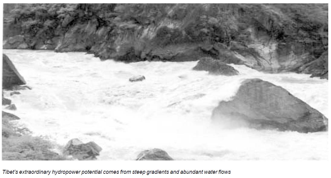
At Mt. Namchakbarwa (7,756 metres) near the Tibetan village of Jodong in Southern Tibet, the Yarlung Tsangpo enters a canyon that has been recently recognised as the longest and deepest canyon in the world (Ciu Bian in Beijing Review, 30 March – 5 April 1998). The Yarlung Tsangpo Gorge is eight times as steep and three times as large as the Colorado in the Grand Canyon (McRae 1999). The river descends over 3,000 metres in approximately 200 km (Alford 1992) and this constitutes one of the greatest hydropower potentials anywhere in the world. Where the river emerges from the canyon it enters India’s northeastern state, Arunachal Pradesh.
At a July 1986 conference in Alaska, in which projects under the Global Infrastructure Fund (GIF) were discussed, the “Himalayan Hydropower Project” was short-listed. This envisaged a series of 11 dams around the “Brahmaputra loop” and included a tunnel through the mountains bringing water to a powerhouse projected as having a capacity of 48,000 Megawatt. The overall capacity of the “loop” was speculated to be 70,000 Megawatt (Verghese 1990).
It is unclear what has happened to this ambitious plan; the GIF certainly no longer publicises it. However, Chinese engineers may be pursuing the idea of a single mega power station with an installed capacity of around 40,000 Megawatt. By comparison the largest power station in operation today isItaipú in Brazil, with a total installed capacity of 12,600 Megawatt. Three Gorges Dam, currently under construction on the Yangtze River, will have a capacity of 18,200 Megawatt. It would become the world’s biggest dam.
This project has also been associated with plans to divert water from the Yarlung Tsangpo to the northwestern deserts of China using so-called “Peaceful Nuclear Explosions” (PNEs) to drive an underground tunnel through the mountains (Horgan 1996). China signed the Comprehensive Nuclear Test Ban Treaty in 1996, which disallows PNEs. Further, there are serious doubts as to whether this is even possible.
On January 7, 1998 ZDF television reported on its programme “Die Welt” that indeed a large dam twice as big as Three Gorges was proposed on the Yarlung Tsangpo and
interviewed the Chief Planner, Professor Chen Chuanyu. Chen described the plan to drive a 15 km (9.3 miles) long tunnel through the Himalayas to divert the water before the bend and direct it to the end of the bend. This would shorten the distance of the roughly 3,000 metres altitude drop from 200 km to just 15 km. The hydropower potential was given as 40,000 Megawatt. He further describes using the power to pump water to Northwest China over 800 km (497 miles) away.
The Yarlung Tsangpo, before it emerges from the great canyon onto the Indian plain, constitutes 33 per cent of the total flow of the Brahmaputra, based on mean annual flow (Alford 1992). It may constitute a larger proportion of stable flow from glacial sources. The implications of a huge storage dam on the Yarlung Tsangpo for India and Bangladesh would be far reaching. These countries would be at the mercy of China for adequate releases of water during the dry season, and for protection from flooding during the rainy season. A massive diversion of this water to China’s northwest would be even more devastating. Nutrient-rich sediments that enrich the soils of India and Bangladesh would be held back in the reservoir. The river’s delta will become deprived of silts; thousands of fish species which rely on the delta for breeding and raising young will be affected, as well as the maintenance of the delta itself.
The reservoir for such a huge dam could stretch hundreds of kilometres up the Yarlung Tsangpo well into the Kongpo region. This would inundate vast areas of virgin forest within the canyon and beyond. And as much of the flora and fauna within the canyon is undocumented, rare species of flora and fauna which have yet to be scientifically studied could be lost. It is said to be home for more than 60 per cent of the biological resources on the Tibetan Plateau (China Daily1998b).
Water Pollution
According to the 1996 ‘TAR’ environment report published in the Tibet Daily in June 1997, the trend in the Kyichu (Lhasa River) basin is towards increased pollution. The report stated that a total of 41.9 million tons of waste liquid was discharged in 1996, 25.4 million tons was from industrial sources. Pollutants included cyanide, arsenic, sulphides and nitrates. The Toelung River, a small tributary of the Kyichu was reported to be lightly polluted with arsenic and fluorine.
Despite this, water quality was said to be generally good (Tibet Daily, 27 June 1997). Increasing pollution from industrial, domestic and agricultural sources are a major
concern considering the predicted increases in industrial and agricultural activities in future years. With increasing use of chemical fertilisers throughout the Yarlung Tsangpo watershed, prospects for the maintenance of the river hitherto clean waters are not good. This should be of major concern to all downstream users.
Flood Deaths
At a time when nearly half the deaths from nature are caused by floods, the summer of 1998 saw severe flooding in the Yarlung Tsangpo watershed, all over Tibet. At least 53 people were killed in heavy flooding across 40 counties of the ‘TAR’. Water levels were apparently at a record high level in the Yarlung Tsangpo and Kyichu Rivers. It was reported that at least 400 yaks and sheep were killed and that 80,000 people were affected by the flooding. Tourists returning from Tibet at the time said roads between Lhasa, Gyangtse and Shigatse were impassable. Boulders and rocks were strewn around the valley floors where flash floods had washed them down from mountainsides (TIN September 1998). The causes of the extreme flooding are difficult to assess, and were probably the result of a mixture of factors.
comment 0